The work behind every asset and permit, in one place.
CentricityIQ runs the operations side of local government — service requests, work orders, inspections, and permits — on top of the ESRI GIS your city already trusts.
Built by Centricity GIS — an ESRI partner with 23 years of infrastructure asset management and permitting systems experience, putting them into the field for cities.
Asset management and permitting, built as equals.
Most cities run these on two disconnected systems. CentricityIQ keeps the crews in the field and the permits at the counter working from the same map, the same records, and the same assistant.
Asset Management
Live now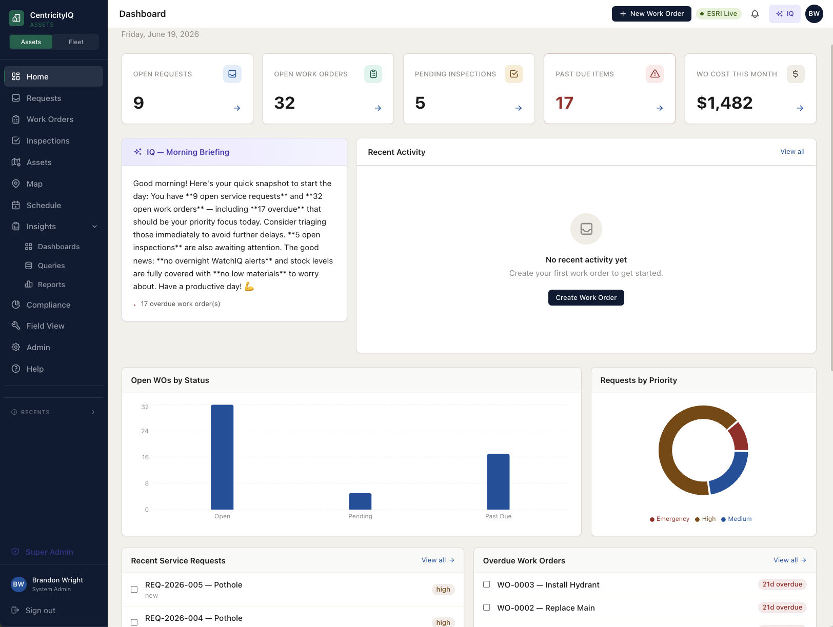
- Service requests, work orders & inspections on your live ESRI layers
- Labor, material & equipment costing on every work order
- IQ assistant answers questions and builds the record for you
Permitting
Early accessSoonNow in early access
- Applications, plan review & inspections for building and code
- Citizen-facing portal for submittals and status
- Shares the same map, contacts & assistant as Asset Management
The last generation of this software wasn’t built for the cities that need it most.
Small and mid-size municipalities got enterprise complexity, enterprise pricing, and implementations measured in quarters. CentricityIQ is a different starting point.
GIS-native, not GIS-adjacent
Your ArcGIS is the system of record. We store an ObjectID and a layer reference — never a copy of your geometry — so the map is always live and always yours.
AI woven through, not bolted on
Classify a request, pre-fill a work order, flag an inspection anomaly, or ask a plain-English question of your own data. The assistant is on every screen.
Configured in weeks, not quarters
A guided setup stands up your types, crews, and layers without a six-figure consulting engagement. You go live before the budget cycle closes.
From connection to crews-in-the-field.
Connect
Point CentricityIQ at your ESRI Feature Services. The guided setup reads your layers and proposes your asset structure.
Configure
A setup assistant helps you shape work order types, inspection checklists, and crews — in your language, not a vendor template.
Go live
Field staff work from the map on any device. Requests, costs, and inspections flow into one queryable record from day one.

“I’ve spent 23 years standing up the last generation of municipal asset software in real cities. CentricityIQ is everything I learned about what those teams actually needed — and never got.”
Brandon Wright, President of Centricity GIS — an ESRI partner with 23 years of infrastructure asset management and permitting systems experience. CentricityIQ is built by practitioners who’ve been in the field, not by an enterprise software conglomerate.
Questions we hear from cities.
What is CentricityIQ?
CentricityIQ is municipal asset management and permitting software for cities, counties, and utility districts. It runs on top of a local government’s existing ESRI GIS and covers service requests, work orders, inspections, materials, equipment, fleet, and reporting — with an AI assistant built into every screen. It is made by Centricity GIS, LLC.
Who is CentricityIQ built for?
CentricityIQ is built for small and mid-sized local governments — typically cities, counties, and utility or special districts that need real asset management but do not have a dedicated CMMS administrator on staff. It is designed to be configured and run by the same people who use it.
How is CentricityIQ priced?
CentricityIQ is priced as a flat annual subscription per module, with no per-user fees and no per-module add-on charges. Pricing scales with the size of the organization rather than the number of people who log in, so adding staff never increases the cost.
Does CentricityIQ replace our GIS?
No. CentricityIQ does not replace or duplicate your GIS — it reads it live. Your ArcGIS remains the system of record for asset geometry and attributes, and CentricityIQ stores only a reference to each feature, so the map is never out of sync.
Is CentricityIQ available now?
CentricityIQ Asset Management is available today. CentricityIQ Permitting is in early access and ships on the same platform, sharing the same map, contacts, and login.
See CentricityIQ on your own GIS.
We'll connect a live walkthrough to your actual ESRI layers, so you're looking at your city — not a demo dataset. Permitting cohort spots are open too.