CentricityIQ Asset Management
Everything a public works team does in a day — requests, work orders, inspections, and cost — on top of your live ESRI map, with an assistant on every screen.
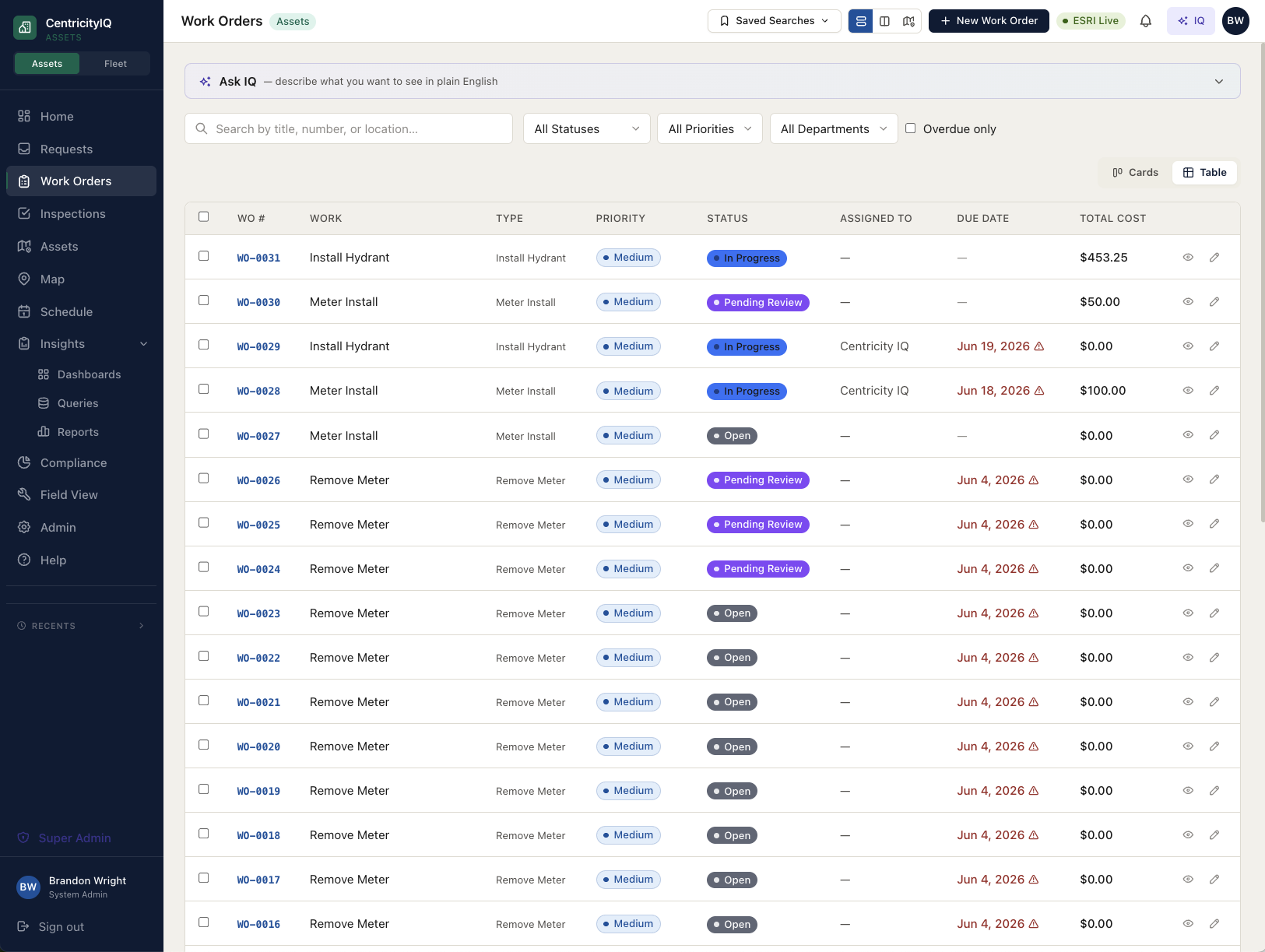
Requests, work orders & inspections
One connected lifecycle. A citizen request becomes a work order becomes an inspection — each one linked to the same asset on the same map, with a full audit trail behind it.
- Multi-asset work orders from map selection
- Configurable inspection checklists with pass/fail logic
- Auto-numbered records with a live status flow
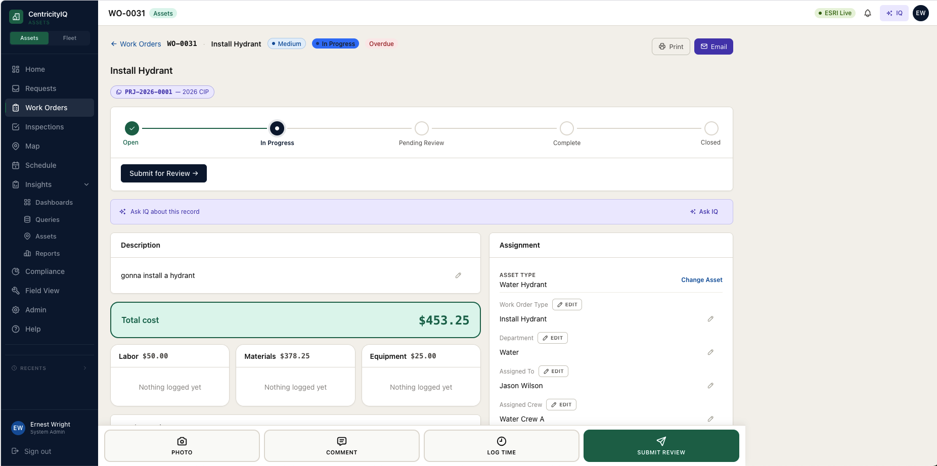
True cost on every job
Labor, materials, and equipment captured as real line items — not a single guessed number. Roll it up by crew, asset, or department and report on it in Insights.
- Employee rates applied automatically to labor
- Per-warehouse material inventory
- Cost that flows straight into dashboards & reports
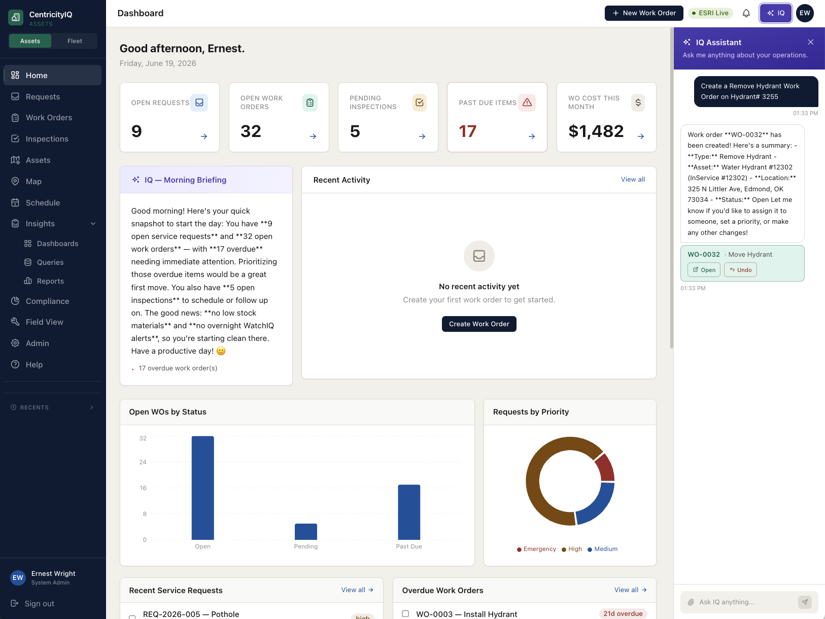
IQ — the assistant on every screen
Ask a plain-English question of your own data, classify an incoming request, pre-fill a work order from asset history, or flag an inspection reading that looks wrong.
- Natural-language queries → charts & tables
- Anomaly flags on out-of-range readings
- Setup assistant configures your org for you
Questions we hear from cities.
Does CentricityIQ work with our existing ArcGIS?
Yes — it’s GIS-native. It reads your live ESRI Feature Services and stores only a reference (the ObjectID and layer URL), never a copy of your geometry, so your GIS stays the system of record and is always current.
How long does it take to go live?
Weeks, not quarters. A guided setup reads your layers and helps you configure work-order types, inspection checklists, and crews — without a six-figure consulting engagement.
Can we track labor, material, and equipment cost?
Yes. Every work order captures cost as real line items, rolled up by crew, asset, or department and reportable in Insights — not a single guessed number.
Do field crews need special hardware?
No. It runs in the browser on phones and tablets, so crews work from the map on any device they already have.
What is a CMMS, and does a small city need one?
A CMMS (computerized maintenance management system) is software that tracks maintenance work against physical assets — what was done, to what, by whom, and at what cost. A small city needs one at the point it can no longer answer questions like "how much have we spent on that lift station this year?" or "which hydrants are overdue for inspection?" from spreadsheets.
Can CentricityIQ schedule preventive maintenance?
Yes. Recurring maintenance runs on configurable work cycles that generate work orders automatically on a date schedule, and readings that fall outside an acceptable range can spawn a corrective work order on their own.
Can we manage vehicles and equipment in the same system?
Yes. Fleet management is part of the same platform, so vehicle work orders, inspections, parts, and preventive maintenance live alongside infrastructure assets under one login and one set of reports.
See it on your own GIS.
We'll connect a walkthrough to your actual ESRI layers so you're looking at your city, not a demo dataset.